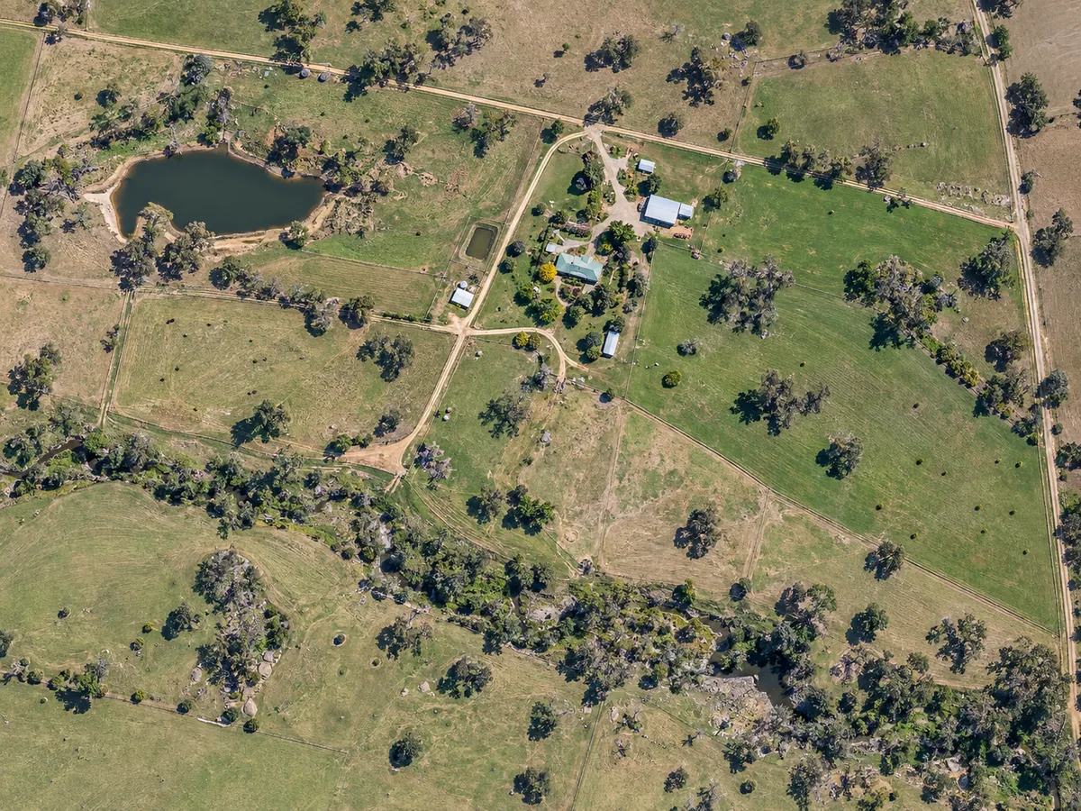
Orthomosaic map
A stitched overhead image of a paddock, worksite or property for planning, records and approximate measurement.
Illustrative capability example.
From farm and property mapping to civil progress, thermal, multispectral, LiDAR, 3D models and environmental monitoring, we build the capture and deliverable around what the project needs to achieve.
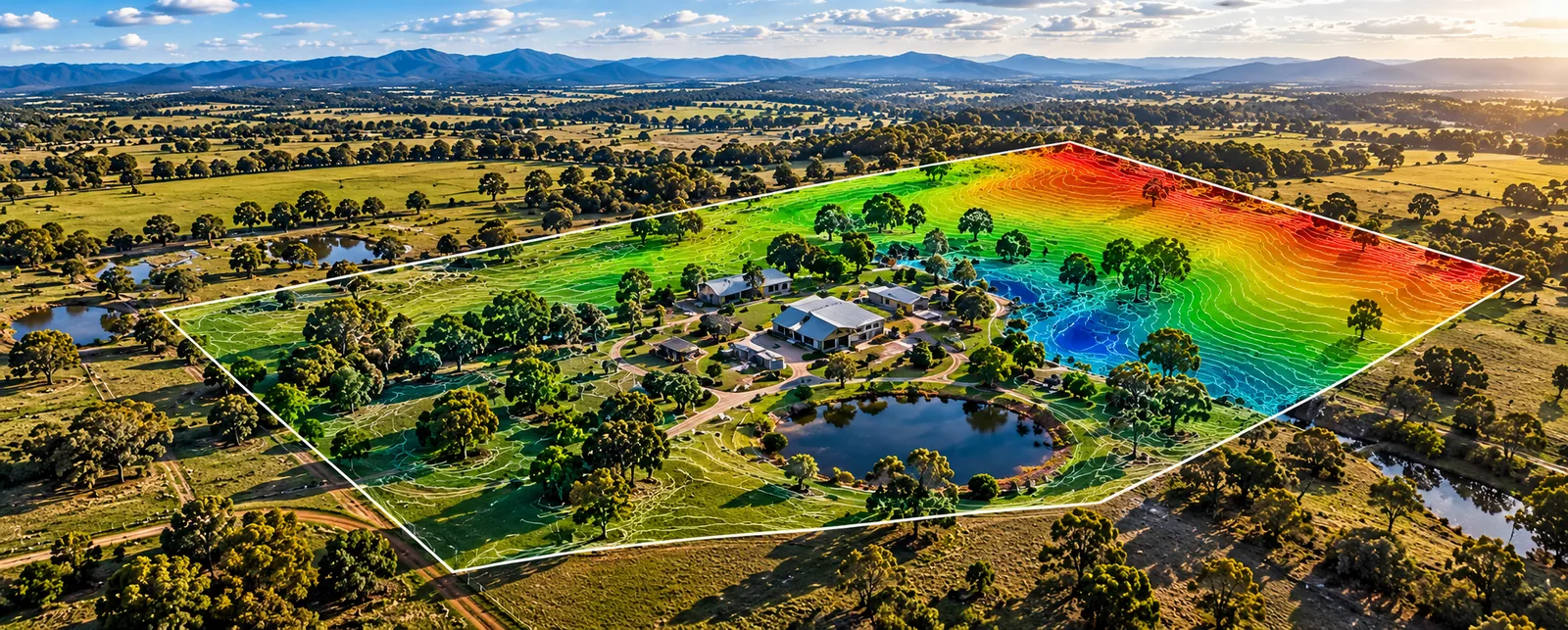
This is a standard service today, priced per property. You get current, stitched overhead imagery of the ground as it actually is, plus practical maps, measurements and organised outputs to support planning and work on the property.
The finished package is matched to the job so you know what files and information you are paying for before capture starts.
The exact output depends on the job. These examples show the kinds of mapping, measurement and remote-sensing deliverables that can be supplied for suitable projects.
A stitched overhead image of a paddock, worksite or property for planning, records and approximate measurement.
Illustrative capability example.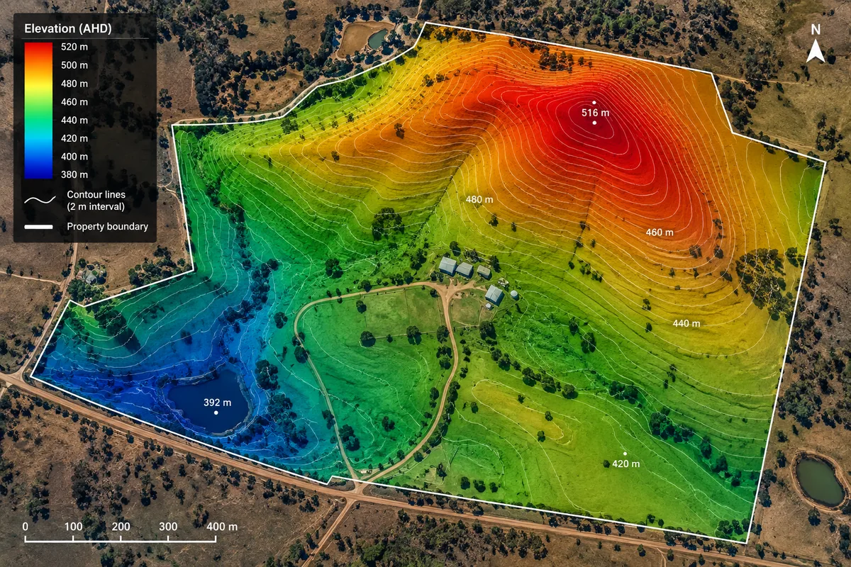
Terrain-style outputs for understanding slope, drainage and site shape when the required capture method supports it.
Illustrative capability example.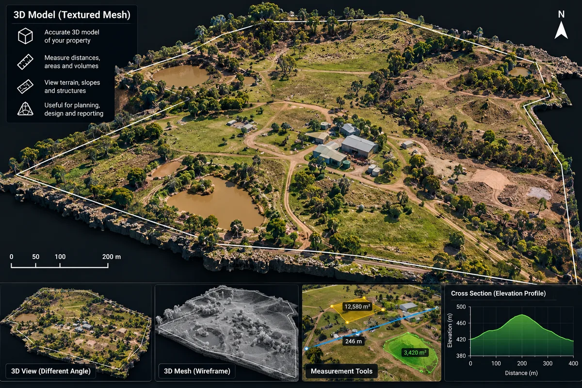
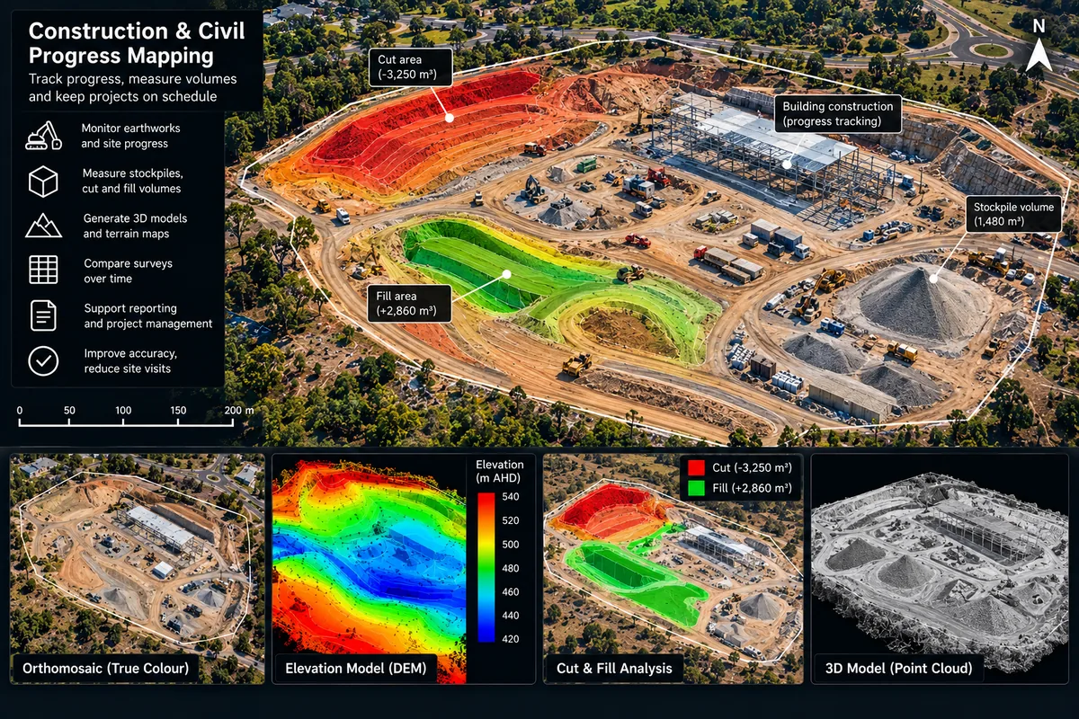
Photogrammetry models and volume work can be scoped where the project, accuracy and quality checks justify it.
Illustrative capability example.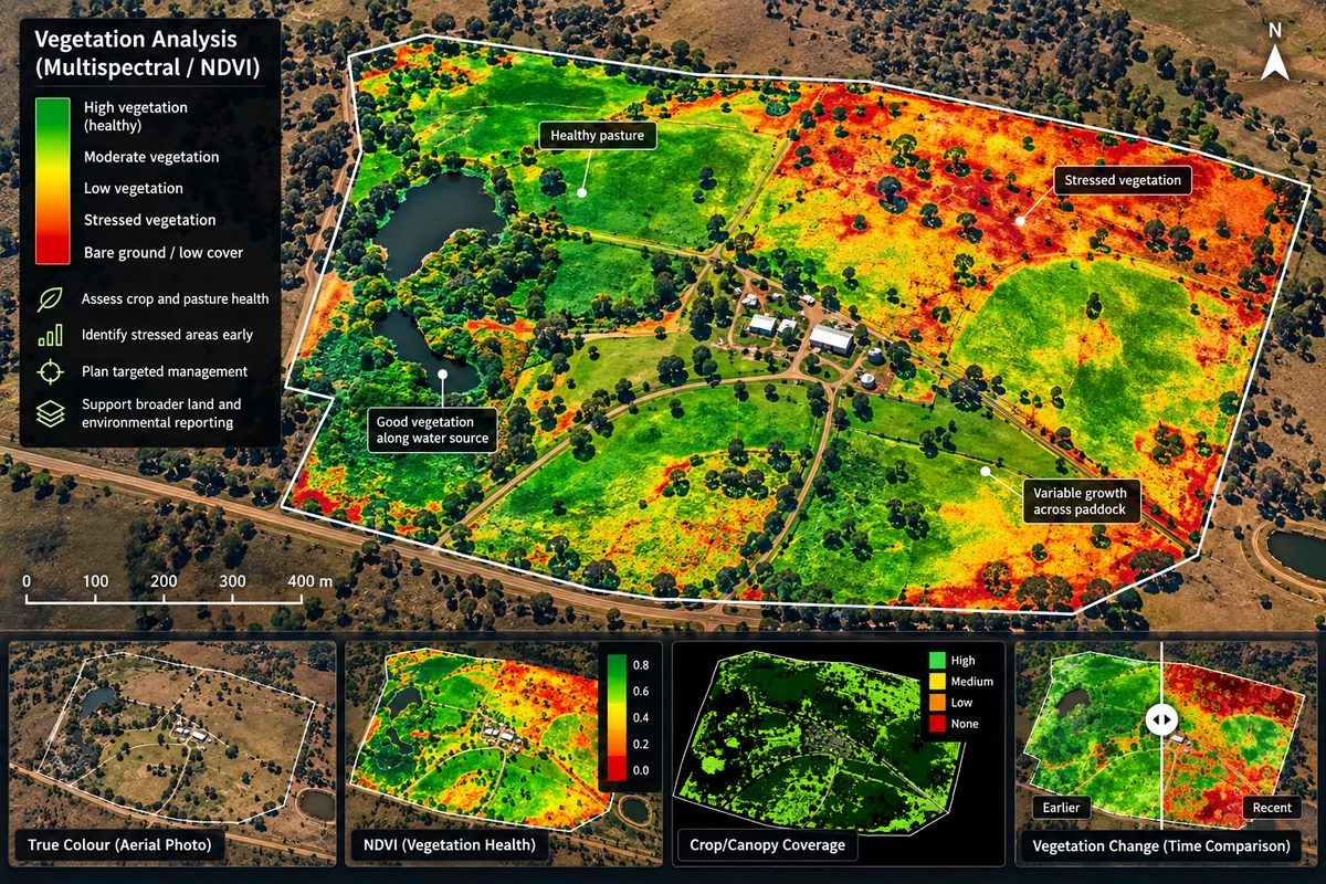
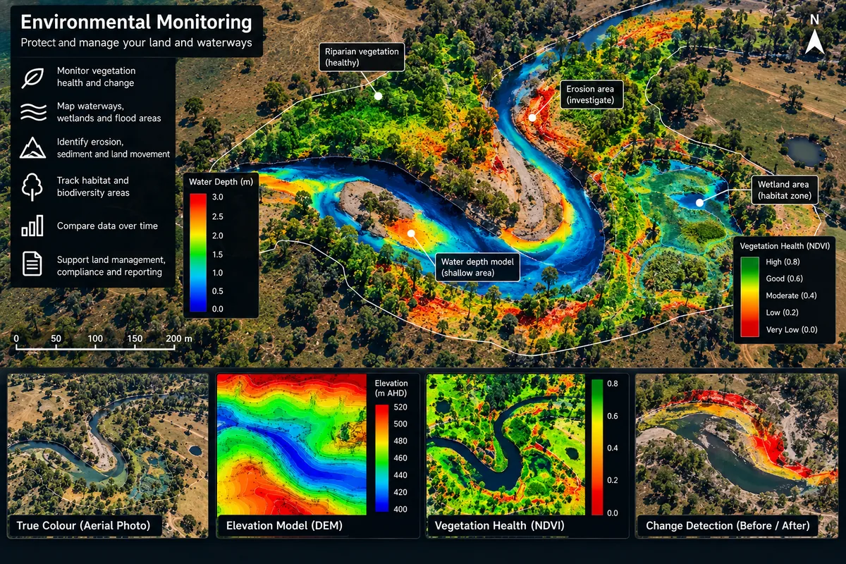
Specialist multispectral or vegetation-index work can be arranged when the project needs information beyond normal visible-light imagery.
Illustrative capability example.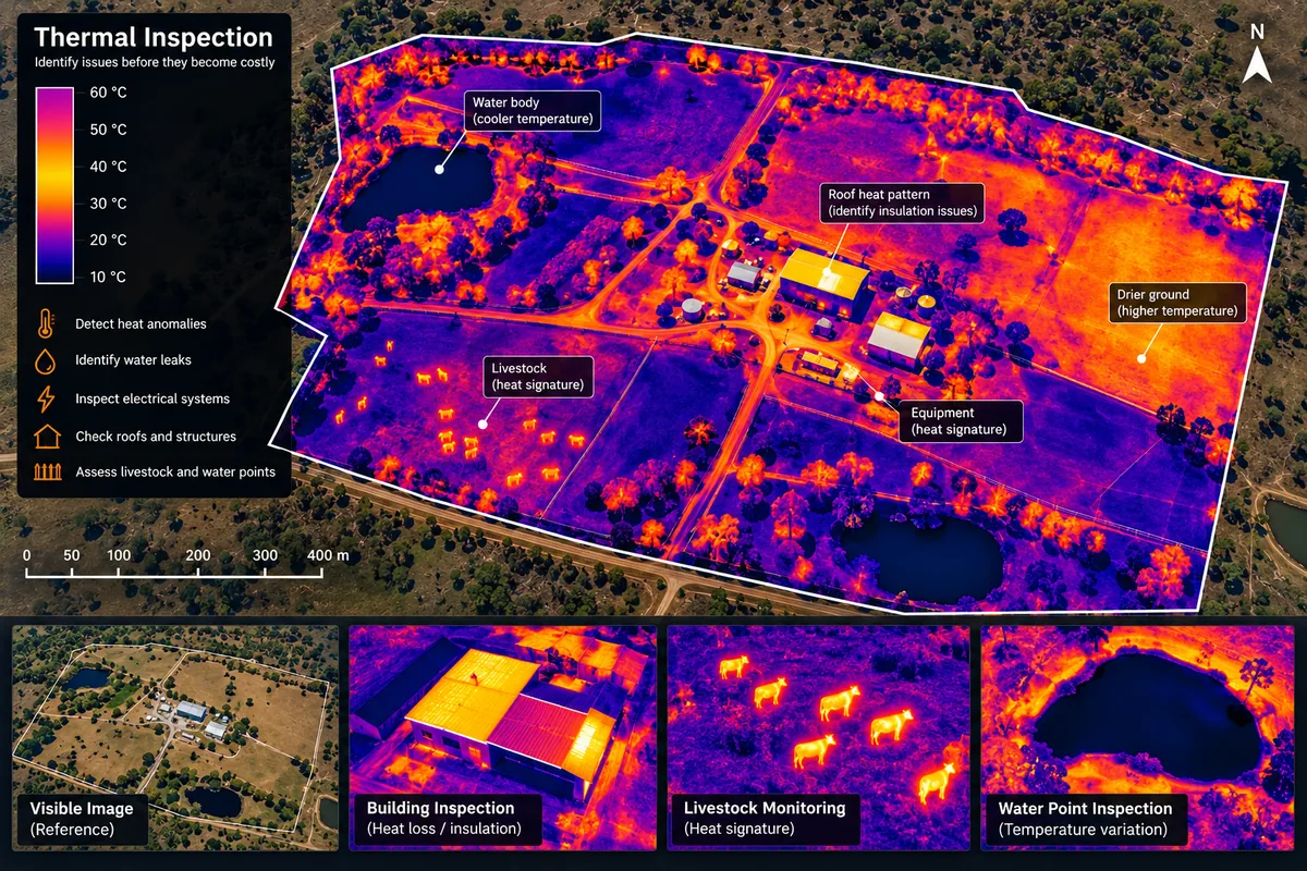
Thermal capture can be arranged for suitable inspection work where temperature differences are relevant to the job.
Illustrative capability example.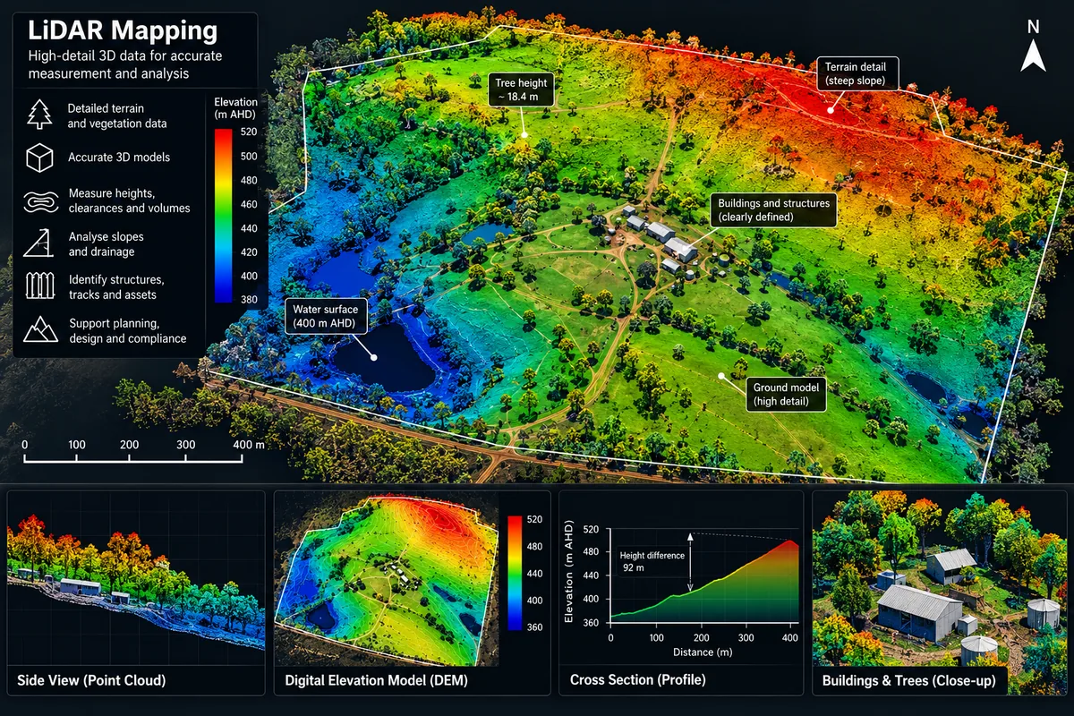
Advanced terrain and point-cloud acquisition can be sourced for projects that need a different sensor or workflow.
Illustrative capability example.Illustrative capability examples. Exact outputs, measurements, accuracy and presentation are confirmed for each project.
We scope the outcome first, then match the capture method and deliverable to what the client actually needs.
Paddock maps, farm assets, visible problem areas, drainage imagery and repeat records.
Site overviews, progress capture, quantities or terrain outputs where the required accuracy is agreed first.
Repeat site records and volume-oriented workflows when the project specification supports them.
Visual inspection, condition records and hard-to-reach imagery without unnecessary access equipment.
Current site imagery, repeat monitoring, vegetation context and specialist remote-sensing capture where required.
Progress evidence, before-and-after records, site context and organised handover for stakeholders.
Tell us what the finished result needs to achieve. We scope the capture method, data quality, processing and deliverable around the project requirement.
All prices below include GST. They are starting points for standard local conditions; the written quote confirms the exact site, output, timing and travel before you commit.
Organised high-resolution views of an accessible roof, gutter, shed, tank or other nominated asset.
A planned set of current aerial photos and short video clips for property records, planning or promotion.
Up to 5 hectares: stitched overhead imagery with agreed approximate measurements and an organised handover.
Repeatable views for construction, land, maintenance or cleaning progress, planned around agreed milestones.
| Larger mapping and capture | Starting price |
|---|---|
| Mapping 5–20 hectares | From $1,650 incl. GST |
| Mapping 20–50 hectares | From $2,750 incl. GST |
| Mapping over 50 hectares | Custom quote |
| Capture-only half day | From $825 incl. GST |
| Capture-only full day | From $1,485 incl. GST |
No vague "fully certified" claims. These are the current approvals the work is flown under — see the full qualifications & accreditations page.
These services use compact-drone capture and a straightforward delivery workflow. The job is priced around the site, access, travel and the information you need—not the number of minutes in the air.
Tell us the outcome, required accuracy and finished format. The project is then built around the capture method and data needed to deliver it.
Higher-accuracy mapping and survey-grade workflows are available where the project requires them, with the control method and deliverable standard agreed before capture.
Thermal inspections, multispectral capture, NDVI and vegetation analysis for agriculture, environmental, infrastructure and asset work.
High-detail terrain, vegetation and asset data for advanced modelling, clearances, earthworks, infrastructure and environmental projects.
Photogrammetry models, stockpile volumes, cut-and-fill analysis and repeat progress datasets scoped to the project requirements.
Map treatment zones, calculate areas and quantities from selected application rates, monitor establishment, and provide aerial seeding solutions for suitable projects.
Georeferenced imagery, layers, maps, point clouds and organised outputs for owners, planners, contractors, managers and advisers.
We already use aerial imagery to inspect and quote property work. That field experience helps us capture what a contractor, owner or manager actually needs to see.
Roofs, gutters, visible solar condition, rural assets and hard-to-reach maintenance areas.
Progress records, before-and-after capture, site overviews and repeat views at agreed milestones.
Capture-only work completed to an agreed shot list or flight specification and returned for your own processing.
Clear imagery, repeatable viewpoints and documented observations for maintenance, condition records and project planning.
From practical planning maps through to higher-accuracy workflows, the capture and processing method is matched to the accuracy the project requires.
Vegetation, drainage, change detection, seeding and revegetation planning, multispectral analysis and other remote-sensing outputs can be scoped around the decisions the client needs to make.
Every flight is checked against the airspace, weather, people, access, visibility, permissions and operating conditions that apply to the site.
Roofs, gutters, sheds, tanks, visible solar panels, drainage, fences and other accessible assets. We provide a practical visual record, not a structural, electrical, building or insurance certification.
Yes. Tell us who will use the result and we can agree on organised stills, short clips, a progress sequence or a simple visual summary.
Yes, by project. Approximate operational maps are not cadastral surveying or a legal boundary determination, so we agree the accuracy and deliverable before quoting.
Yes. Paddock and whole-property orthomosaics, farm asset maps, visible weed and problem-area mapping, drainage and water-flow imagery, area and distance measurements, repeat pasture records, seeding and revegetation planning and GIS-ready capture are available now.
Accuracy is matched to the purpose of the project. Planning and farm-management work can use approximate measurements, while higher-accuracy, RTK and survey-grade workflows are scoped to the required standard. Legal boundary or cadastral deliverables follow the applicable professional requirements.
Yes. Thermal, multispectral, NDVI and other specialist remote-sensing projects are available for suitable sites. We confirm the required outputs, sensor requirements and accuracy before quoting.
Yes. We can map treatment areas, calculate hectares and quantities from the selected application rate, prepare practical paddock or rehabilitation plans, monitor establishment, and scope aerial seeding solutions for suitable projects.
Yes. P&Z holds current CASA operator accreditation for commercial operation to 6 September 2029, and the DJI Mini 4 Pro is registered with CASA for commercial use to 6 September 2027. Every flight is operated within CASA's standard operating conditions.
It is the minimum final invoice for a booked drone service, not the price of every service. Mapping, progress programs and longer capture work use their published package starting prices. All published prices include GST; site complexity and agreed travel may change the written quote.
Yes. We can supply georeferenced imagery and the flight data so it drops into GIS, farm-management or agronomy software for further planning. Tell us the format your adviser wants before the flight.
Yes. We are based in Tamworth and service New England and North West NSW as standard, and we quote projects across regional NSW and beyond. Travel work is priced individually — mobilisation, travel and accommodation appear in the quote and are agreed before we commit, so you see the real cost up front. Tell us where the site is and we will say plainly whether the trip makes sense.
No. Airspace, weather, people, access, visibility and site hazards all matter. If the job cannot be completed within the applicable operating rules, we do not fly it under the basic service.
AI may help organise imagery, flag areas for human review and draft a report. A person checks the result, and AI is not used as a substitute for a qualified structural, electrical, surveying or other specialist opinion.
Tell us the address, paddock or property size, what you need mapped, and the format your agronomist, planner or software needs. If accuracy matters, say so—we will agree it before quoting.
Your details are only used to quote and do the job — see our Privacy Policy.